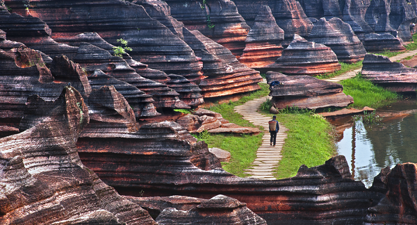
China's geological wonders are here! October 6 marks the second International Day for Geological Diversity
Release time:2023-10-06 Reading times:
The earth is the cradle and home of human existence, geological diversity plays a key role in the development of human civilization, but this recognition has not been paid attention to, as the deep world under our feet, they are silent but bearing everything, people need to pay attention to the earth again when they look up at the stars.
First Approach the International Day for Geological Diversity
01 Why is International Diversity Day established?
With the increasing urgency of global environmental issues and the importance of Earth sciences, the UNESCO General Conference officially approved the establishment of October 6 as the International Day for Geological Diversity on 22 November 2021, with the aim of raising global public awareness of geological diversity and promoting geoscience knowledge. And to celebrate human achievements in the earth sciences.
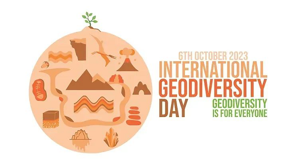
Every year, October 6 will be an opportunity for the public to fully realize the important links between geological diversity and other life, in order to remind people to pay attention to, protect the earth's resources and geological heritage, and promote harmonious coexistence between people and nature.
October 6, 2023 is the second International Day for Geological Diversity, with the message:
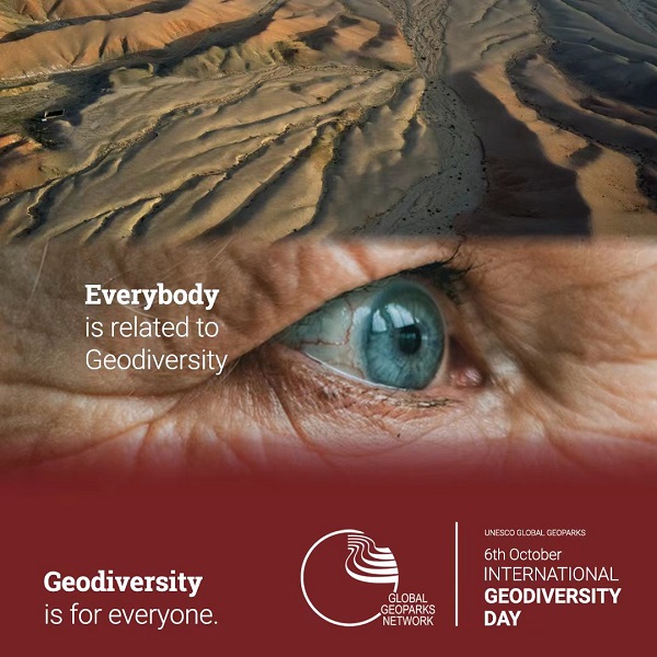
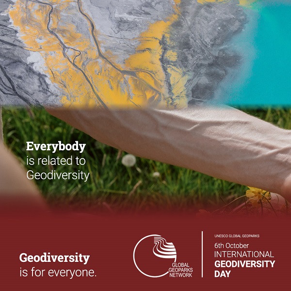
Geodiversity is for everyone -Everybody is related with Geodiversity.
Geological diversity belongs to everyone - everyone has something to do with it.

02 What is geological diversity?
Geological diversity refers to the diversity of non-living elements in nature (both on the surface and within the Earth), including minerals, rocks, fossils, soils, sediments, landforms, landforms, geological and geomorphic processes, and hydrological features such as rivers and lakes. At the same time, the term "geological diversity" also covers the processes that create and alter these features.
03 What is the significance of understanding geological diversity?
Geological diversity is related to the development of human civilization
The development of human civilization is inseparable from the utilization of geological materials and resources. From the Stone Age to the present, the historical process of human beings is inseparable from geological diversity. Rocks, metal ores, fossil energy, even the silicon that makes chips, are all provided by geological diversity. Through soil and water, geological diversity is also the cornerstone of all agricultural systems in the world, and the productivity of human civilization depends on geological diversity.
Geological diversity is related to natural ecology
Geological diversity is the basis of all biological diversity. It creates the conditions for life to originate and flourish, and is the cornerstone of all environments and ecosystems on Earth, and protecting geological diversity is protecting biodiversity.
Geological diversity is relevant to the response to environmental crises
Through the study of the mechanism of geological and geomorphic processes, people can prevent the risks of earthquakes, tsunamis, volcanoes, floods, landslides and other disasters, and scientifically plan production and living areas, reducing a large number of life and property losses.
Even the geological diversity of ancient times also records the Earth's past climate and environmental changes, which can help people to examine and respond to the current and future climate crisis.
The International Day of Geological Diversity is not only a day to share Earth science content, but also a day to remind us to cherish our planet and protect its geological diversity.
Second Where is China's geological diversity?
Global geoparks around the world are living examples of geological diversity. As one of the most landform rich countries in the world, China has a large number of geological resources and wonders, on the basis of which 41 global geoparks have been established, showing the diversity and richness of geological elements such as minerals, rocks, fossils, soils, sediments, landforms and landforms.
These global geoparks are not only valuable resources for scientific research, but also excellent places for people to explore the mysteries of the earth and feel the charm of nature. They are also heaven for geoscience lovers and professional researchers who want to experience China's geological diversity. The story of the earth has long been hidden here.
The introduction and photos in this article are only the "tip of the iceberg" of the global geoparks. Welcome to the field and enjoy the great beauty of China!
PART1 In 2004, China's first list of global Geoparks
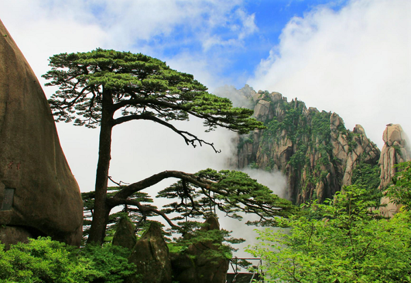
Huangshan World Geopark
"Rocks, clouds and carved pine trees combine to form a unique landscape that shapes art and culture."
China Huangshan World Geopark is located in Huangshan City, Anhui province, covering an area of 160.6 square kilometers. It consists of nine scenic spots, such as Warm Spring, Yuping, Beihai, Cloud Valley, Pine Valley, Fishing Bridge, Ocean Lake, Fuxi and Fugu Temple. It is mainly characterized by granite peak forest landform, with typical geological remains such as sculpting stones of different shapes, Quaternary glacial remains, water landscape, rare animals and plants, and rich ecological resources.
Huangshan is famous for its high and steep peaks, with 72 peaks over a kilometer. There are many "U" shaped valleys and "V" shaped valleys spread radially from the center of Huangshan to all sides. The mountain tops, mountainsides and valleys are widely distributed with granite forests and pillars. The main types are dome peak, cone peak, ridge peak, column peak, box peak and so on.
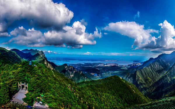
Lushan World Geopark
"Integration of Geology and Culture"
China Lushan Global Geopark is located in the north of Jiangxi Province, facing the plains of the middle and lower reaches of the Yangtze River and the banks of Poyang Lake. It is distributed with rivers, lakes, slopes, peaks and other landforms, and has a complete ecosystem. It covers an area of 500 square kilometers and is divided into two parks in the north and south of the mountain. The main geological relics include strata, rocks, structures, sediments, hydrogeology and geomorphology.
So far, more than 100 important glacial geological relics have been found in Lushan Mountain, which have completely recorded the whole process of ice and snow accumulation, glacier formation, glacier movement, rock erosion, rock transport, and mud and gravel deposition, and have preserved historical records of paleoclimatic changes and geological characteristics in eastern China. In addition, Lushan Mountain is not only an ancient Chinese educational base and religious center, but also a famous summer resort at home and abroad. There are more than 600 villas with architectural styles from 18 countries, such as Britain, the United States, Germany and France.

Yuntaishan World Geopark
"Three steps to a spring, five steps to a waterfall, ten steps to a lake pool."
China Yuntaishan Global Geopark is located at the southern foot of Taihang Mountain, north of Jiaozuo City, Henan Province. It covers an area of 556 square kilometers, of which the core area covers 323 square kilometers. The geopark includes five parks: Yuntai Mountain, Qinglong Gorge, Fenglin Gorge, Qingtian River and Shennong Mountain. It is mainly characterized by the structural single-sided mountain landform, cliffs, waterfalls, valleys and clear springs of Yuntaishan Park.
The "Yuntai landform" landscape in the park is a special landscape mainly formed by tectonic action and natural erosion. It is a new type of landform, which has both aesthetic appreciation value and typicality.
Shilin World Geopark
"Shilin Karst Museum" and "The First Wonder under Heaven"
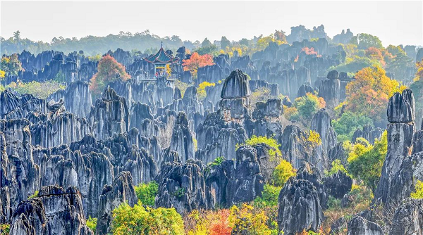
China Shilin Global Geopark is located in the red plateau of Yunnan Province, 78 kilometers away from Kunming City. It is a famous gathering place of karst wonders, covering an area of 350 square kilometers. The geopark consists of stone Forest scenic spot, Naigu Stone Forest scenic spot, Long Lake Scenic spot, Daishui scenic spot and other scenic spots, which is one of the most charming geological wonders in the world.
The stone forest has experienced a long and complex geological evolution process of 270 million years. In the geoparks, sword-shaped, columnar, mushroom-like and tower-shaped stone forests are distributed in clusters on hillsides, gullies and depressions, reflecting the main stone forest forms in the world. The park also has stone teeth, dissolve hills, depressions, dissolve lakes, funnels, karst caves, hidden rivers, Tiansheng Bridges and waterfalls, etc. It is a karst landform area with rich types, scientific and aesthetic characteristics, and is known as the "Stone Forest Karst Museum" and "the first wonder under the heaven".

Danxia Mountain World Geopark
"The color is as good as Dan, and the color is as bright as rosy clouds."
China Danxia Mountain Global Geopark is located in the northeast of Shaoguan City, Guangdong Province, with a total area of 292 square kilometers. It is named for Danxia landform. Danxia Mountain is composed of red sand conglomerate, with red cliffs as the feature, looks like Chicheng layers, clouds and clouds patches, the ancients took "color such as wodan, can if bright Xia" meaning, called Danxia Mountain.
The material basis of Danxia landform is the red fluvial lacustrine conglomerate formed in the Late Cretaceous 90 million to 70 million years ago. In the long period of time, the intermittent uplift effect has made the landform of this area have undergone earth-shaking changes. The earth's internal and external forces work together to shape the Danxia Mountain beautiful and colorful, 680 rocks scattered, the image of thousands, like a ruby sculpture garden.

Zhangjiajie World Geopark
"Extremely rare sandstone peak forest landform in the world"
Zhangjiajie Global Geopark is located in the northwest of Hunan Province. It is a transitional zone between the northeast of Yunnan-Guizhou Plateau and the middle and low mountainous areas of the northwest of Hunan Province in southwest China. It covers an area of 398 square kilometers. It contains sandstone mountain forest, square mountain fortress, bridge stone gate, barrier valley, karst canyon, karst cave, spring waterfall, stream lake and sediment, structure, stratigraphic section, paleontological fossils and other colorful geological relics.
There are more than 3,000 stone cliffs in the geopark, of which more than 1,000 are more than 200 meters high. Golden whip Rock up to 350 meters, the stone peak shape is different, beautiful and spectacular, is the world's very rare sandstone peak forest landform, has great scientific research value.
Wudalianchi World Geopark
"A natural volcano museum with all the volcanic landscapes one would want to find"
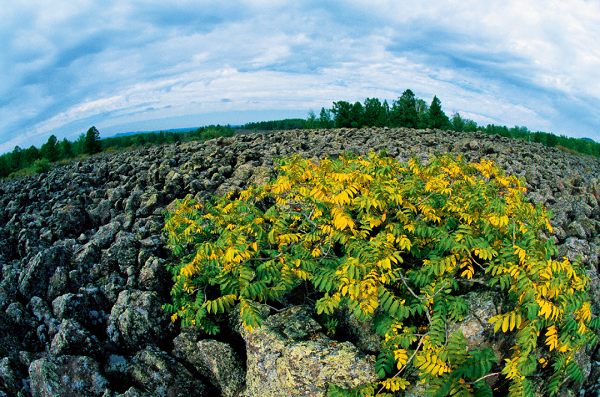
China's Wudalianchi Global Geopark is located in the north-central part of Heilongjiang Province, in the transition zone from the Lesser Hinggan Mountains to the Songnen Plain, with a total area of 790.11 square kilometers.
There are 14 new and old volcanoes in the park, with the world's most complete, most concentrated, most complete categories, the most typical new and old volcanic geological landforms, such as stone dragon, stone sea, lava waterfall, lava tunnel, lava stalemulsion, elephant's nose lava, flower lava, jet cone dish, volcanic gravel and volcanic bomb and other microgeomorphic landscapes. Scientists call it a "natural volcano museum" and an "open volcano textbook." The five beaded lakes connected by tidal water were formed when volcanic magma filled the vast ancient depression basin Lake Udlin Pool in the latest period, hence the name Wudalian Pool.
Songshan World Geopark
Zhong Yue, one of the "five mountains"
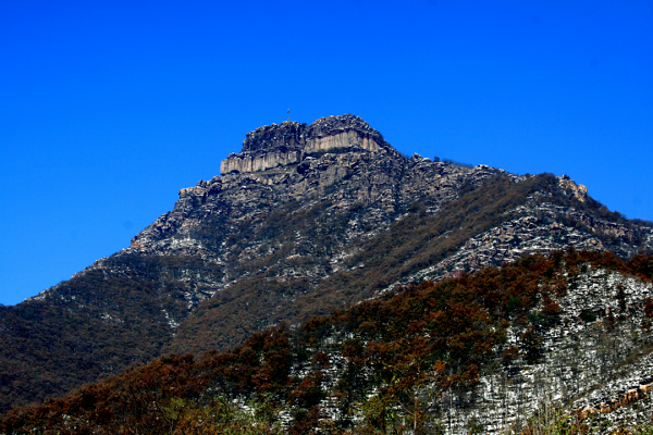
China Songshan Global Geopark is located in Dengfeng City, Henan Province, covering an area of 464 square kilometers, including Anpo Mountain, Wufo Mountain, Block Yang Mountain, Shaolin Temple, Sanhuangzhai, Junji Peak, Zhifang Lake, Luya Waterfall, Wuzhi Ridge, Shiconghe River and other 10 scenic spots and Dengfeng service area. The main type of geological remains is geological (including structural) section.
Within the scope of the geopark, the strata of five geological historical periods, Archean, Proterozoic, Paleozoic, Mesozoic and Cenozoic, have been continuously and completely exposed for 3.5 billion years, with clear stratigraphic sequence and typical structural features, which is called "five generations under one roof" by the geological circle. In the main peak area of Songshan Mountain, Yuzhai Mountain, Junji peak, Wuzhiling Mountain, Jianshan Mountain, etc., are mostly composed of quartzite, and caused by tectonic movement, which makes the peaks rise up on the ground at 400 meters high.
PART2 List of the second batch of Global Geoparks in China in 2005
Yandang Mountain World Geopark
"Permanent Documents for the Study of Mesozoic volcanic Eruptions"
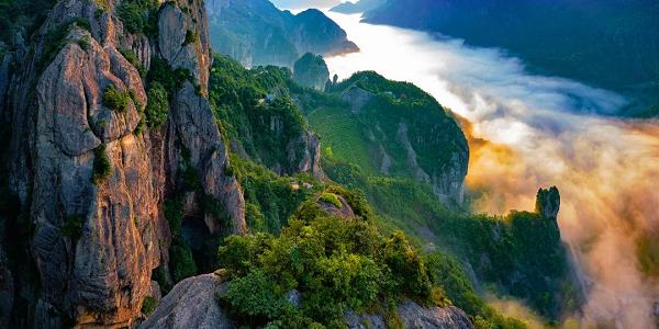
China Yandang Mountain Global Geopark is mainly located in Yueqing City, Wenzhou City, Zhejiang Province, and some are located in Yongjia County and Wenling City. It is 300 kilometers away from Hangzhou and 70 kilometers away from Wenzhou. The total area is 298.8 square kilometers, including 3 parks. The main park includes Lingfeng, Sanfold waterfall, Lingyan, Daguqiu, Yanhu West stone beam cave, Xiansheng Gate, Xianqiao - Longhu, Yangjiao Cave and other scenic spots, the east park includes Fangshan, Changyu Adit, and the West park is Nanxi River.
Yandang Mountain is a typical representative of Cretaceous volcanoes in the giant volcanic (rock) belt of the Asian continental margin, and is a natural museum for the study of rhyolitic volcanic rocks. Yandang Mountain records the evolution history of a resurrected volcanic eruption from 128 million to 108 million years ago. Due to the frequent activity of ancient volcanoes, the mountain shows unique peaks, columns, peaks, caves, walls and other strange rocks, which is called a geomorphic museum.
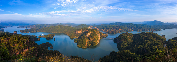
Taining World Geopark
Danxia Cave Museum
China Taining Global Geopark is located in Taining County in the northwest of Fujian Province, covering an area of 492.5 square kilometers. It is composed of four parks, Shiwang, Dajin Lake, Baxian Cliff, Jinao Mountain and Taining Ancient City tourist area. It is a Danxia landform as the main body, with granite, volcanic rocks, structural geological landforms and other geological relics, with good natural ecology. A comprehensive geopark with rich cultural landscape.
Complex natural processes have sculpted the gully landscape of the geoparks. There are more than 80 line valleys (one line day), more than 150 lane valleys, more than 240 canyons composed of canyon group, with its deep canyons, towering cliffs, numerous caves, ecological nature. The large number of Danxia caves in the geopark, the large scale of cave groups, the strange shape and combination of caves, and the rare ornamental value of caves are called "Danxia Cave Museum".

Keshketen Global Geopark
"The combination of mountains and deserts creates a unique landscape and forms a unique culture."
China Keshketen Global Geopark is located in Hexigten Flag, Inner Mongolia Autonomous Region, by Dalinor volcanic landform park, Qingshan Yanpu granite landform park, Ashatu granite forest park, Hunshandak sand Park, Xilamulun Grand Canyon park, hot water pond hot spring park and Huanggangliang Quaternary glacial relics park and other 9 parks. It covers an area of 1343 square kilometers. The main landscapes include Quaternary glacial remains, granite forest, rock mortar landform, trough and platform tectonic boundary, plateau lakes, rivers, volcanic landform, desert, grassland, hot springs and plateau wetlands.
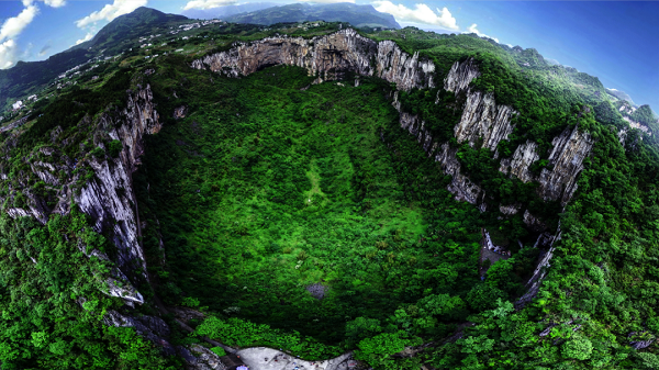
Xingwen World Geopark
"The earliest sinkhole research and naming site in China"
Limestone is widely distributed in the park, and the special geographical location, geological tectonic environment and climatic environment have formed Xingwen karst landform.
The huge sinkhole in the geopark is the earliest research and naming place of sinkhole in China, and it is also one of the typical areas to study karst geomorphology in Southwest China. The park has preserved carbonate strata of various ages dating back about 490 million to 250 million years, and the strata contain extremely rich Marine paleontological fossils and sedimentary facies markers.
PART3 List of the third batch of global Geoparks in China in 2006
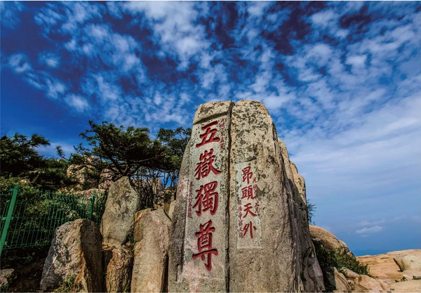
Taishan World Geopark
"The oldest stratum in North China"
Taishan Global Geopark is located in Tai 'an City in central Shandong Province, covering an area of 158.63 square kilometers. It is divided into Taishan core Park and peripheral park. Taishan is located in the west of the tectonic active belt of the eastern continental margin of China, in the Luzhong Long fault zone of the Luxi block of the North China Platform, and is a secondary tectonic unit of the North China platform.
Taishan is rich in geological relic resources, which have important research value for the geological sciences such as petrology, stratigraphy and paleontology, sedimentology, tectonics, geomorphology and earth history. It has become a classic area that is the hot spot and focus of the geological research of pre-Cambrian and neotectonic movement in the world. Among them, Taishan Group is the oldest stratum in North China, which records a long and complex evolutionary history of nearly 3 billion years since Archean. At the same time, Mount Tai has a long history, is the symbol of the Chinese nation's pragmatic and enterprising spirit, and the history and culture of Mount Tai is also the epitome of the history and culture of the whole Chinese nation.

Wangwu Mountain - Daimeishan World Geopark
"The oldest rocks are over 2.5 billion years old."
China Wangwushan-Daimeishan Global Geopark is located in the west of Jiyuan City and the north of Xin 'an County, covering an area of about 986 square kilometers. It is divided into two parks: Wangwu Mountain and Xiaolangdi, including five scenic spots: Tiantan Mountain, Xiaolangdi, Wulongkou, the Three Gorges of the Yellow River and Xiaogoubei. Supplemented by paleontological fossils, water landscape and geological engineering landscape, the comprehensive geopark is characterized by the mutual glow of ecology and humanity.

Leiqiong World Geopark
"Maar Crater Lake formed by an explosion after groundwater contact with lava."
China Leiqiong Global Geopark is located on both sides of Qiongzhou Strait in the southern tip of China, with a total area of 3,050 square kilometers. It consists of Haikou Park in Hainan Province and Zhanjiang Park in Guangdong Province. There are 101 volcanoes in the park. Volcanic types cover almost all types of basaltic magma eruptions and steam magma eruptions. It is the first of the Quaternary volcanic belt in China, and is a natural textbook of Quaternary basalt volcanology.
The two zones both developed Maar Volcano, which was formed by the eruption of steam magma interacting with hot magma and cold water. Huguang Yan Maar Lake is the beginning of China's Maar Lake research, and is the base of Sino-German scientists' cooperation research. Haikou City and Zhanjiang City are national historical and cultural cities, and the volcanic culture of harmonious development of human activities and volcanoes (basalt) constitutes the unique and strong cultural heritage of the park.
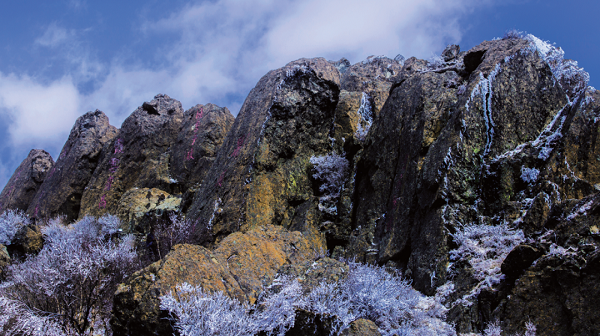
Fangshan World Geopark
"With 313 cultural sites, including the Great Wall, its legacy goes far beyond geology"
China Fangshan Global Geopark is located about 40 kilometers southwest of Beijing, spanning between Fangshan District of Beijing and Laishui and Laishuan counties of Baoding City and Hebei Province. With a total area of 1045 square kilometers, it mainly includes eight major areas, namely: Zhoukoudian Peking Man Site science popularization area, Shihuadong Cave Group sightseeing area, Shidu Karst Canyon comprehensive tourism area, Shangfang Mountain - Yunju Temple religious culture tourist area, Shenglian Mountain sightseeing experience area, Baihua Mountain - Baicao bank ecological tourism area, Laishui County Yesanpo comprehensive tourism park and Baishi Mountain Zhumayuan peak cluster waterfall tourism area.
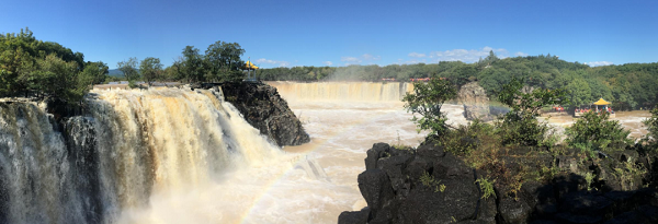
Jingpo Lake Global Geopark
"Jingpohu Volcano has erupted at least three times in the past 12,000 years."
China Jingpo Lake Global Geopark is located in Ning 'an City, southeast of Heilongjiang Province, in the middle and upper reaches of Mudanjiang River, more than 80 kilometers away from Mudanjiang City, with an overall planning area of 1726 square kilometers. Including seven geological heritage scenic spots and ancient Bohai national scenic spot, a total of nine scenic spots.
In 12000 ~ 5140 years ago, there were many volcanic eruption activities, lava slurry blocked the Mudanjiang ancient river, forming the world's largest volcanic lava barrier lake - Jingpo Lake, leaving a typical, rare, systematic and complete volcanic geological heritage landscape and beautiful water landscape and canyon wetland natural geological landscape.

Funiu Mountain World Geopark
"Thirteen different types of dinosaur egg fossils have been found and exhibited, including two very rare specimens."
China's Funiu Mountain Global Geopark is located in the eastern part of China's central orogenic system and the hinterland of Funiu Mountain Range in Henan Province. It covers an area of 5858.52 square kilometers and is a comprehensive geological science park of continental orogenic belt type.
The geomorphic landscape of the geopark shows the relationship with orogeny, especially the "Jagging Ridge" geomorphic landscape, "Yanpanshan" geomorphic landscape, "Wuxing Mountain" landscape, "unloading and cracking" landscape, "Shizhu peak cluster" landscape, which reflects the diversity of granite geomorphic types in the orogenic belt. The "plastic rheological" landscape reflects the karst geological features and heterogeneity of the orogenic belt.
In the natural reserve of the Cretaceous Dinosaur egg Group belonging to the Geopark, 36 species of Cretaceous dinosaur egg fossils have been found in 8 families, 12 genera, of which Xixia giant long egg is rare in the world, and Gobi prismatic egg is rare.
PART4 The fourth batch of Global Geoparks in China in 2008
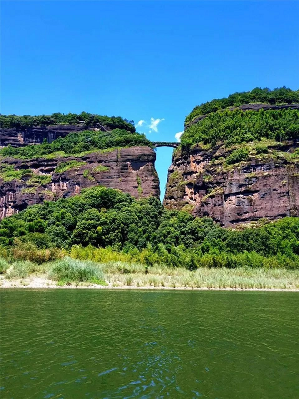
Longhu Mountain World Geopark
"The geopark combines multiple cultures such as Taoism, Buddhism and Confucianism, and is also the birthplace of cliff tomb culture and Taoism."
China Longhu Mountain Global Geopark is located in Yingtan City, Jiangxi Province, covering an area of 996.63 square kilometers, including Longhu Mountain Park, Guifeng Park and Xiangshan Park. It is a geological park with Danxia landform as the main body and various types, both volcanic landform and tectonic landform. The Danxia landform here is dominated by the adult period, and is typical of the late adult period. The juvenile period, the adult period and the old period are all developed, and the sequence is complete.
The landform landscape of Longhu Mountain is a comprehensive geopark with rich content and outstanding features, integrating Danxia landscape with Taoist culture, cliff burial culture and Buddhist culture.
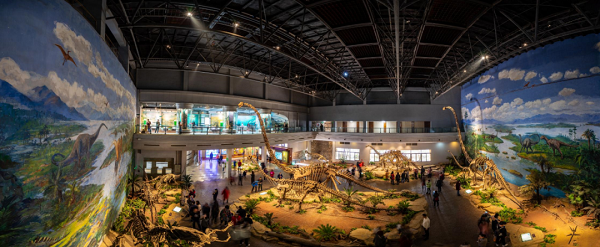
Zigong World Geopark
"A more than 150-million-year-old dinosaur site, a 2,000-year-old salt city"
China Zigong Global Geopark is located in Zigong City, Sichuan Province, with a total area of 1630.46 square kilometers. Zigong is not only a famous salt capital, but also an important source of dinosaur fossils in China.
The world-famous Dashu dinosaur fossil site in Zigong City has unearthed a large number of precious dinosaur fossils, becoming a rare fossil treasure house. Its dinosaur fauna includes 3 classes, 11 orders, 15 families and nearly 20 species, and a number of precious companion animal fossils have been unearthed. In this fossil group, quite a few are new genera and new species, there are Asia's second longest dragon up to 20 meters long, plant-eating long neck sauropod dinosaurs, fierce carnivorous dinosaurs, small bird dinosaurs and very precious primitive stegosaurus, which are rare in the strata of the same geological age at home and abroad, and have high scientific research value and sightseeing value. For Chinese and foreign tourists to provide a thrilling spectacle, known as "dinosaur caves, wonders of the world" and "China's national treasure".
PART5 List of the fifth batch of global Geoparks in China in 2009
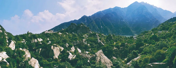
Zhongnanshan Qinling World Geopark
"Rich geological remains, magnificent landscapes, rich biological species, good environment and rich historical culture"
China Qinling Zhongnanshan Global Geopark is located in the middle of Qinling Mountains, only 25 kilometers away from Xi 'an, with a total area of 1074.85 square kilometers and the distribution area of the main geological relics of 890 square kilometers, which is divided into five parks with unique themes. The most distinctive geological remains in the park are orogenic belt geological remains and Quaternary geological remains, such as landslides, Quaternary ancient glacier remains and so on.
Zhongnan Mountain is the Qinling complex continental orogenic belt, located in the center, and has become the natural dividing line of geology, geography, ecology, climate environment and even humanity in the north and the south of China. It is unique in the global geological commonality, and its orogenic belt and basin mountain geological science are rich, typical, concentrated and representative, so it has long attracted the attention of geoscience circles at home and abroad.
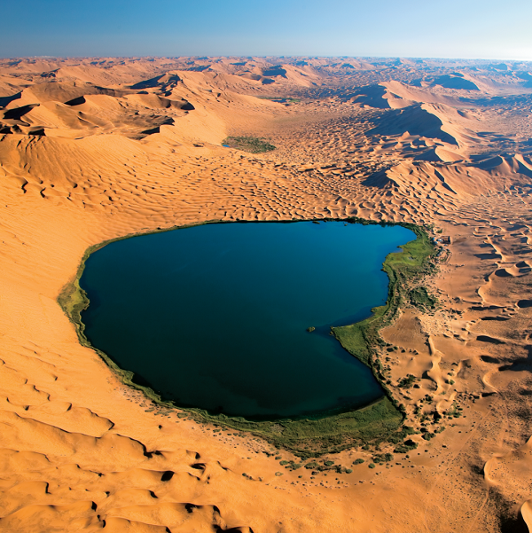
Alxa Desert World Geopark
"A sea of singing sand"
China's Alashan Desert World Geopark is located in the Alashan League in the westernmost part of the Inner Mongolia Autonomous Region. It consists of three parks, Badain Jaran, Tengger and Juyan, and 10 scenic spots to which they belong. The total area is 630.37 square kilometers. Its special geographical location, geological structure, ecological environment and climatic conditions have formed a geological landscape dominated by desert and Gobi, and preserved various typical geological relics formed by wind erosion geological processes in northwest China, integrating desert, Gobi, granite wind erosion landforms and paleontological fossils, systematically and completely demonstrating the geological processes of wind erosion.
PART6 List of the sixth batch of Global Geoparks in China in 2010
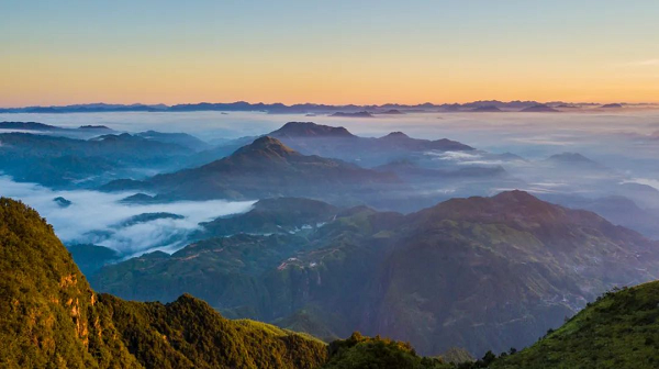
Ningde World Geopark
"Integrated geode granite landform, volcanic landform, river bed erosion landform, coastal sea erosion landform"
China Ningde Global Geopark is located in Ningde City, Fujian Province. It consists of three parks, Baishuiyang, Baiyun Mountain and Taimu Mountain, with a total area of 2660 square kilometers and a core area of 383 square kilometers.
The geopark is located in the southeast of the Eurasian continental plate and belongs to the activation belt of the continental margin of the Pacific Ocean. The park is located in the Mesozoic volcanic eruption belt along the southeast coast of China, which is an important part of the volcanic belt around the Pacific Ocean. At the same time, the park is also a part of the alkali rich miaolitic granite belt more than 1000 kilometers from the coast of Zhejiang, Fujian and Guangdong to South Korea, and the typical rock mass of miaolitic granite is exposed, which has important scientific research significance and investigation value.
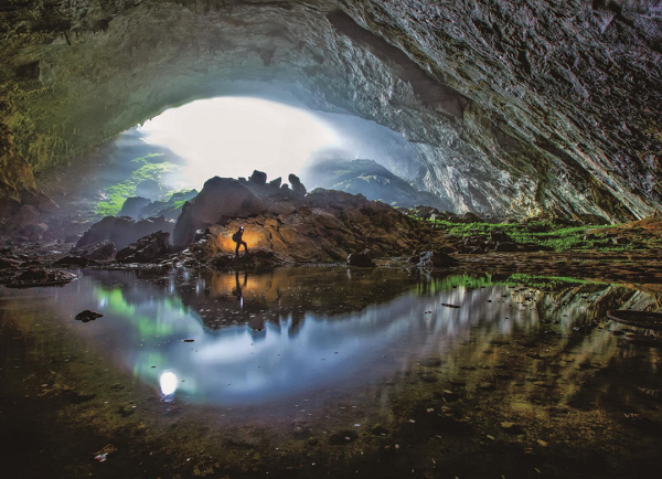
Leye - Fengshan World Geopark
"Cave Home and the world's Longest Natural Bridge"
Located on the slope of the transition from Yunnan-Guizhou Plateau to Guangxi Basin, Leye Fengshan Global Geopark consists of the adjacent Leye Dashiwei National Geopark and Fengshan Karst National Geopark. It includes eight scenic spots and two geological museums with a total area of 930 square kilometers.
In the typical massive karst area of Leye-Fengshan Geopark, there are two underground river systems, forming a mature peak landscape, the world's largest Tiankeng group of Leyedashiwei, the most concentrated Fengshan cave hall, skylight group, the largest span of Tiansheng bridge and typical cave sediments, and the most complete skull fossils of early giant panda species. As well as the diversity of flora and fauna preserved in the unique Tiankeng ecological environment, such as Tiankeng plant community, Buliu River valley forest community, China orchid village and cave animal community, these resources have important scientific research significance and high aesthetic appreciation value.
PART7 List of the seventh batch of global Geoparks in China in 2011
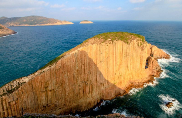
Hong Kong Global Geopark
"An urban geopark with rare acidic rock columns, diverse coastal landforms and extensive sedimentary rocks"
Hong Kong Global Geopark is located in Hong Kong, China. It consists of the Sai Kung Volcanic Rock Park and two sedimentary rock parks in the Northeast New Territories, including eight scenic spots, and the Sai Kung Volcanic Rock Park includes four scenic spots, namely, Fong Shuen Wan, Weng Kung Islands, Kwo Chau Islands and Kiu Tsui Chau. The sedimentary rock Park in the Northeast New Territories includes Tung Ping Chau, Yan Chau Tong, Cheung Mun and Chi Chau - Wong Chuk Kok Tsui scenic spots, with a total area of 49.85 square kilometres.
The geological remains are hexagonal acidic volcanic rock columnar joints of the Mesozoic Cretaceous, characterized by the stratigraphic, paleontological, sedimentary and tectonic geological remains of the Paleogene of the Paleozoic Devonian and Permian, the Mesozoic Jurassic, Cretaceous and Cenozoic.
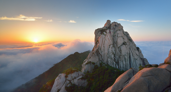
Tianzhushan World Geopark
"One of the cradles of Asian mammals"
China Tianzhushan Global Geopark is located in Qianshan County, Anqing City, southwest Anhui Province, bordering Dabie Mountain in the northwest and Yangtze River in the southeast. It is located in the eastern part of the Dabie orogenic belt between the North China and Yangtze plates and the composite part of the Tanlu fault zone.
Tianzhu Mountain, because the main peak such as "a giant sky" named, also known as Wanshan, enjoy the "ancient southern mountain" respect. This is a classic area of the Dabie Mountain ultra-high pressure metamorphic belt with the largest scale, deepest exposure and richest ultra-high pressure mineral and rock assemblage in the world, and is one of the most typical areas in the world to study continental dynamics. In the north of the park, the granite landforms are magnificent, the peaks are strange, the cliffs are dangerous and the water is beautiful, especially the collapse and accumulation landforms are the most typical, which is called "the most beautiful granite landform on the Tanlu fault zone". The Qianshan Basin in the south of the park produces rich Paleocene mammal fossils, which are rare in Asia, and is recognized as "one of the birthplaces of Asian mammals" and "treasure land of ancient vertebrate fossils".
PART8 List of the eighth batch of global Geoparks in China in 2012
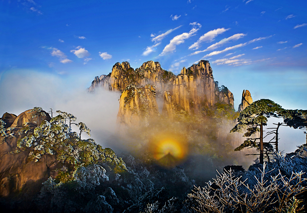
Sanqingshan World Geopark
"A natural Museum of Granite geological geomorphology"
China Sanqingshan Global Geopark is located in Shangrao City, Jiangxi Province, with a total area of 229.5 square kilometers. The geological relics include strata, geological landforms, geological structures, magmatic rocks and so on. The strata include Cambrian, Ordovician (graptolites), Silurian, Devonian, Carboniferous, Permian, Jurassic (continental volcanic rocks, silicified wood), Cretaceous (dinosaur egg fossils), Quaternary system. Geological landforms are steep mountains, low mountains, hills, accumulation and ice erosion and other landforms. Geological structures include anticlinal and synclinal fold structures, normal fault and reverse fault fault structures, peak wall and peak pillar joint structures.
The geopark is a natural museum of granite geological geomorphology. The Chinese Taoist thought of "harmony between heaven and man" has left a rich cultural heritage to the park, which is known as an open-air museum of ancient Chinese Taoist architecture.
PART9 List of the ninth batch of global Geoparks in China in 2013

Shennongjia World Quality Park
The Roof of Central China
China Shennongjia Global Geopark is located in the Shennongjia Forest area of Hubei Province. It consists of five parks: Shennongding, Guanmen Mountain, Tianyan Lake, Dajiu Lake and Laojun Mountain. The total area is 1022.72 square kilometers. The geological relics include late Precambrian strata, mountain landform, canyon landform, karst landform, alpine meadow, glacier landform, fault dome structure, fault structure and water landscape.
The majestic mountain landform, colorful structures, glaciers, water bodies, karst and unique ecological environment and rich biodiversity constitute a natural geological museum, which is the perfect integration of geology, ecology and ancient culture.
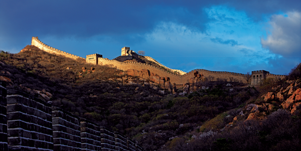
Yanqing World Geopark
"A place where dinosaurs once walked"
China Yanqing Global Geopark is located in Yanqing District, Beijing. It consists of four parks: Longqing Gorge, Guyaju, Qianjiadian and Badaling, with a total area of 620.38 square kilometers. The park is a comprehensive geopark with pre-Cambrian Marine carbonate rock as its material foundation and Mesozoic Yanshan movement geological remains as its core. It is a comprehensive geopark integrating structure, sedimentation, paleontology, magmatic activity and northern karst landform.
Geological relics include northern karst landform, geological structure and paleontology. Karst landforms include peak clusters, canyons, natural Bridges and so on. The geological structures include Hongshiwan vault, Liudaohe anticline, monocline, ripple mark, rain mark, mud crack, stepped fault, mountain front fault and so on. There are sauropod dinosaur tracks, theropod dinosaur tracks, ornithopod dinosaur tracks, silicified wood (white, gray, yellow, brown).
PART10 List of the 10th batch of global Geoparks in China in 2014
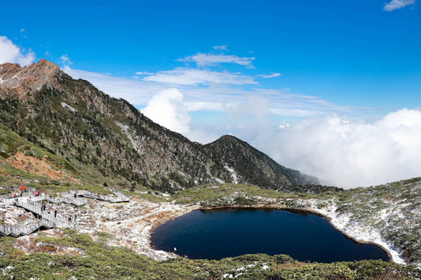
Cangshan World Geopark in Dali
"A sealed geological history of nature written by Nature for more than 2 billion years."
Cangshan Global Geopark is located in Dali City, Bai Autonomous Prefecture, Yunnan Province. It covers an area of 933 square kilometers and consists of three landscapes: Cangshan Mountain, Erhai Lake and foothill plain. Geological relics include structural features, rock landform, glacial landform and water landscape. The structural features include folding, deformation, fracture, etc. Rock landform from SLATE, schist to gneiss, granulite, phyllite, marble, amphibolite, migmatite, cataclastic rock, mylonite, etc., as many as ten kinds, can be called the museum of metamorphic rock. Glacial landforms are mainly distributed on Cangshan Mountain above 2800 meters above sea level, including angular peaks, edge ridges, icehouses, ice pits, glacial valleys, glacial lakes, moraines, moraines, ice sills and other micro-geomorphic combinations.
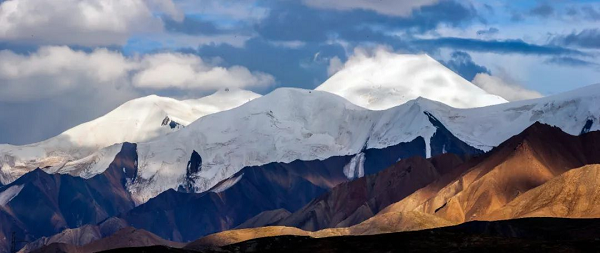
Mount Kunlun Global Geopark
"Mount Kunlun is known as the" mountain ancestor "and holds a special place in Chinese mythology and culture."
Mount Kunlun Global Geopark is located in the eastern part of Mount Kunlun -- southwest of Golmud City, Qinghai Province, 30km away from Golmud city, north to the south mountain pass, south to Kunlun Mountain Pass, west to Datan, east to Tonglu Gully.
The park is famous for its glacial periglacial landforms, earthquake relics and other landscapes, which record several ocean-continental transformations, the uplift of the Tibetan Plateau and five ice ages in the park area. At the same time, the Kunlun Mountain, known as the "ancestor of thousands of mountains", has a prominent position in the cultural history of the Chinese nation since ancient times, and it gave birth to the Kunlun mythological system, one of the Chinese mythological systems. The Kunlun School of Taoism also originated here and has a long history of culture.
PART11 List of the eleventh global Geoparks in China in 2015
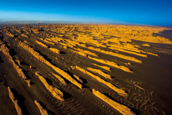
Dunhuang World Geopark
"The Land of Yadan: Rock Outcrops formed by wind Erosion"
China Dunhuang Global Geopark is located in Dunhuang City, Gansu Province, covering an area of 2067.2 square kilometers. It is composed of Yadan Scenic spot, Mingsha Mountain - Crescent Spring scenic spot, natural landscape sightseeing area and cultural heritage sightseeing area. Geological remains include geomorphic remains, sedimentary structure remains, geological structure remains, water landscape remains and stratigraphic remains.
The geomorphic landscape formed by the special geological background and extreme arid climate conditions, and the unique geographical location and cultural sites formed by the ancient Silk Road are integrated here. Rare and typical geological landform landscape, unique natural scenery of the western regions, simple folk customs, rare cultural and historical sites, constitute the most distinctive characteristics of the park, and become a geological scientific investigation, historical and cultural tracing, desert Gobi exploration and leisure vacation tourism resort.

Zhijin Cave Global Geopark
Karst fairyland
China Zhijin Cave Global Geopark is located in Zhijin County, Guizhou Province, covering an area of 170 square kilometers. It consists of three parks: Zhijin Cave, Qijie River and Dongfeng Lake. Geological remains are abundant, including karst remains, paleontological fossil remains, stratigraphic rock remains, structural remains.
The rich geological relics of the lower Triassic Marine carbonate rock as the material basis, concentrated in Zhijin Cave, Qijie River, Dongfeng Lake three relatively independent, but closely linked to the Qijie River karst units, together constitute a cave, canyon, Tiansheng bridge, Tiankeng as the core, a collection of majestic, typical, beautiful and rare plateau karst landscape. And rich and colorful human and biological landscape in one comprehensive geopark.
PART12 List of the 12th batch of global Geoparks in China in 2017

Arshan World Geopark
"The largest volcanic hot spring Geopark in China"
Arshan Global Geopark is located in the northeast of Inner Mongolia Autonomous Region, in the middle of the Greater Hinggan Mountains, with a total area of about 3653.21 square kilometers, with volcanic remains, hot spring landform, granite landform, alpine lakes and plateau meandering river landform as the main features, unique, typical and diverse. It is a geoscience encyclopedia for exploring the uplifting mechanism of the Mongolian Plateau and studying the evolution of the geological environment in northern China. It is the largest volcanic hot spring geopark in China integrating scientific research, ecological tourism, hot spring recuperation, popular science education, leisure vacation and entertainment exploration.
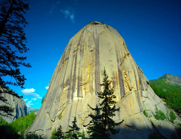
Keketuohai World Geopark
"Gem Town" "Natural Mineral Exhibition Hall"
Located in Fuyun County, Altay Prefecture, northern Xinjiang, 485 kilometers away from Urumqi, it is the first national geoparks in China with typical ore deposits and mine sites as the main landscape. Coupled with the unique granite landform landscape of the Altai Mountains and the remains of the Fuyun earthquake, it has a rich and diverse scientific connotation and aesthetic significance. These geological heritages have a rare value in the world. It forms a dazzling landscape on the mysterious tourism line of Xinjiang Ring Junggar.
PART13 List of the 13th batch of global Geoparks in China in 2018

Huanggang Dabie Mountain World Geopark
"Majestic Mountains, magnificent vistas: Masterpieces of natural erosion"
Huanggang Dabie Mountain Global Geopark is located in Huanggang City, northeast Hubei Province, the southern foot of Dabie Mountain, the north bank of the middle reaches of the Yangtze River, with a total area of 2625.54km². As an important part of the geology-geology-ecology-climate demarcation line of the central mountain system in China, the Huanggang Dabieshan Global Geopark retains multi-stage metamorphism and deformation caused by the evolution of the earth since Archean times, and has rich types of magmatic activity geological remains, which has global comparative significance.
It integrates "peaks, forests, pools and waterfalls" in one place, integrating religious culture, folk customs and historical culture, with lush mountains, fog and sea currents, vast forest and sea, birds and flowers. It is characterized by the structure of continental orogenic belt and granite mountain landform, and has the characteristics of typical, complete, systematic, rare and beautiful geological relics. It is a natural laboratory for geoscience research and orogenic belt research base. A natural protected area with excellent ecological environment, rich history and culture, and high science popularization value.
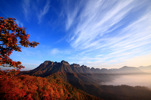
Guangwu Mountain - Nuoshuihe World Geopark
"Trace Earth and human history along the winding Yicang Ancient Road"
Located in the north of Bazhong City, Micangshan area is composed of Guangwushan Park and Nuoshuihe Park, with an area of 1818 square kilometers. The most impressive landscape in the park is the karst landform landscape, including surface and underground karst landform, which is a typical representative of the karst landform in the south-north karst transition area of China, and is an ideal place and key area for the study of karst in China.
The geological connotation of the geopark is extremely deep and wide, which is mainly reflected in the complete typical stratigraphic section of the Yangtze block and its cover layer, karst landform landscape, paleontological fossil landscape, etc. It has important scientific value for analyzing the geological evolution history of the Tethys peripheral Basin, the Qinling (central) orogenic belt and the Sichuan Basin. The evolution and development of the whole Yangtze block is of great scientific significance.
PART14 List of China's fourteen global Geoparks in 2019
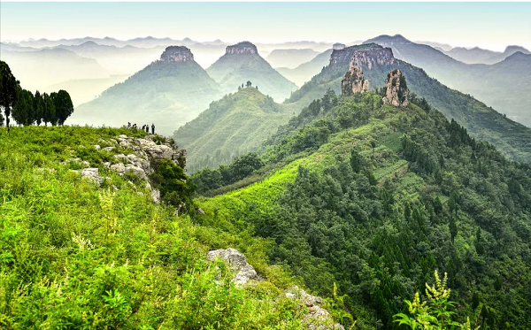
Yimeng Mountain World Geopark
"Unique geological heritage, fantastic scenery, brilliant history"
Yimeng Mountain Geoppark is located in Linyi City, Shandong Province. It consists of Mengshan Park, Diamond Park, Daigu Park, Menglianggu Park and Yunmenghu Park, with a total area of 1804.76 square kilometers.
The geopark is located on the Luxi block west of Yishu fault zone. The most ancient strata, the large-scale Archean intrusive rock series, truly record the history of early crust formation and evolution in northern China. The "money stone" formed by hydrothermal alteration has unique characteristics. Here is China's earliest kimberlite type diamond primary mine, has produced 1.8 million carats of diamonds.
Here is the name of the Dai Gu landform, the Gu group cluster, the form is typical, magnificent. It is also the birthplace of Chinese civilization and the center of Dongyi culture, integrating Taoism, Buddhism and Confucianism. Natural landscape and history and culture merge here, condensing the Yimeng spirit with the significance of The Times.
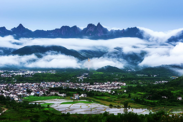
Jiuhuashan World Geopark
"A model of the integration of geological landscape and culture"
Jiuhuashan Geopark is located in Chizhou City, southern Anhui Province. The park covers an area of 139.7km2, with the highest elevation of 1344.4m. Jiuhua Mountain is a natural and cultural heritage site in China, a national scenic spot in China, and one of the four famous Buddhist mountains in China.
With clear, spectacular and beautiful granite complex rock mass, large granite fault block landform and unique fluid-rich granite crystalline structure, Jiuhuashan Geoppark shows outstanding geological relics and models of the melting of the deep crust from the silica-magnesium layer to the silica-aluminum layer and the later tectonic activities during the Eurasian Plate - Pacific plate collision. And with the north subtropical vegetation features and Buddhist culture of the integration of the landscape renowned in the world.
PART15 List of China's 15th batch of global Geoparks in 2020

Zhangye World Geopark
"Witness Colorful Hills and window mullions - Palace Danxia"
Zhangye Geopark is located in Zhangye City, Gansu Province, with Sunan Yugur Autonomous County as the center, covering a total area of 1289.71 square kilometers. The park is located at the first step boundary of the transition from the Qinghai-Tibet Plateau to the Inner Mongolia Plateau and the transition zone from the Qilian Mountains to the Hexi Corridor. The western Jiuquan ophiolite suite is an important material composition of the oceanic crust nearly 500 million years ago, which truly records the evolution of the ancient Qilian Ocean into the Qilian Mountains. The colorful hills are like the colorful silk floating on the Hexi Corridor, which is one of the wonders of geoscience in the world because of its varied colors, strange shapes and grand scale.
Zhangye Geopark is named for the window mullion - palace Danxia. The Heihe River, the second largest inland river in China, runs through the park, nourishing the park's diverse flora and fauna and the multi-ethnic residents represented by the Yugur ethnic group. The abundant neotectonic remains in front of the Qilian Mountains record the uplift of the Qinghai-Tibet Plateau over the past 36 million years. The precious and beautiful geological relics, fragile and diverse ecological landscape, and time-honored and unique ethnic customs have intermingled with each other, creating a rich and colorful resource endowment of Zhangye Geopark, and writing a wonderful chapter of Zhangye on the new Silk Road in the new era.
